UGent team revives the Lost Ports of the Zwin
Medieval Bruges has been coined as “the cradle of capitalism”, a place where goods, ideas and people converged into a unique, international and productive environment. The development of the city into one of Europe’s main commercial hubs was only possible via its connection to the North Sea. A tidal inlet, called the Zwin, linked Bruges to the rest of Europe and beyond and was dotted with a series of outports at its banks: Damme, Monnikerede, Hoeke, Mude and Sluis. Each one of these harbours had a particular role to play in a strongly connected socio-economic network dominated by Bruges. Natural, political and economic factors all resulted in the eventual downfall of Bruges and the Zwin in the 16th century. The outports shrunk from cities into hamlets or even disappeared entirely from the landscape.
In an effort to revive this lost harbour system, an interdisciplinary team of archaeologists, historians and geologists unravelled the topography, chronology and evolution of the landscape and its harbours. In collaboration with Westtoer, the Zwin Nature Park, and with the help of many partners and the creative artists of the Paris-based company Timescope, an ambitious project was set up to bring the results of this UGent research to a wider public. The project ‘Lost Ports of the Zwin’ merges archaeological, historical and geological research into the landscape of the abandoned Zwin ports with immersive VR and AR experiences, based upon the concept of sense of place. This is achieved through a cycle route, along which VR viewers and a Web App visualize what is now lost, and an immersive exhibition, where innovative technologies, such as an AR table, introduce the visitors to new insights on the medieval Zwin and the many people who lived and traded there.
The exhibition at the Zwin Nature Park only runs until November 7. However, the cycle route remains active for a period of three years, until October 2023. For more information and upcoming activities, we refer to www.verdwenen-zwinhavens.be.
At Ghent University and in collaboration with the Belgian Geological Survey, research into this unique maritime-cultural landscape continues. After years of non-invasive actions, a CRA-project now takes a more invasive strategy of on-site coring and excavations. This unique combination of archaeological, historical, and paleo-ecological/geological research will allow a renewed insight of the dynamic interaction between man and nature, the connectedness to the local and global trade network, the transactions in bulk goods and the impact of the many foreigners residing in the area on material culture.
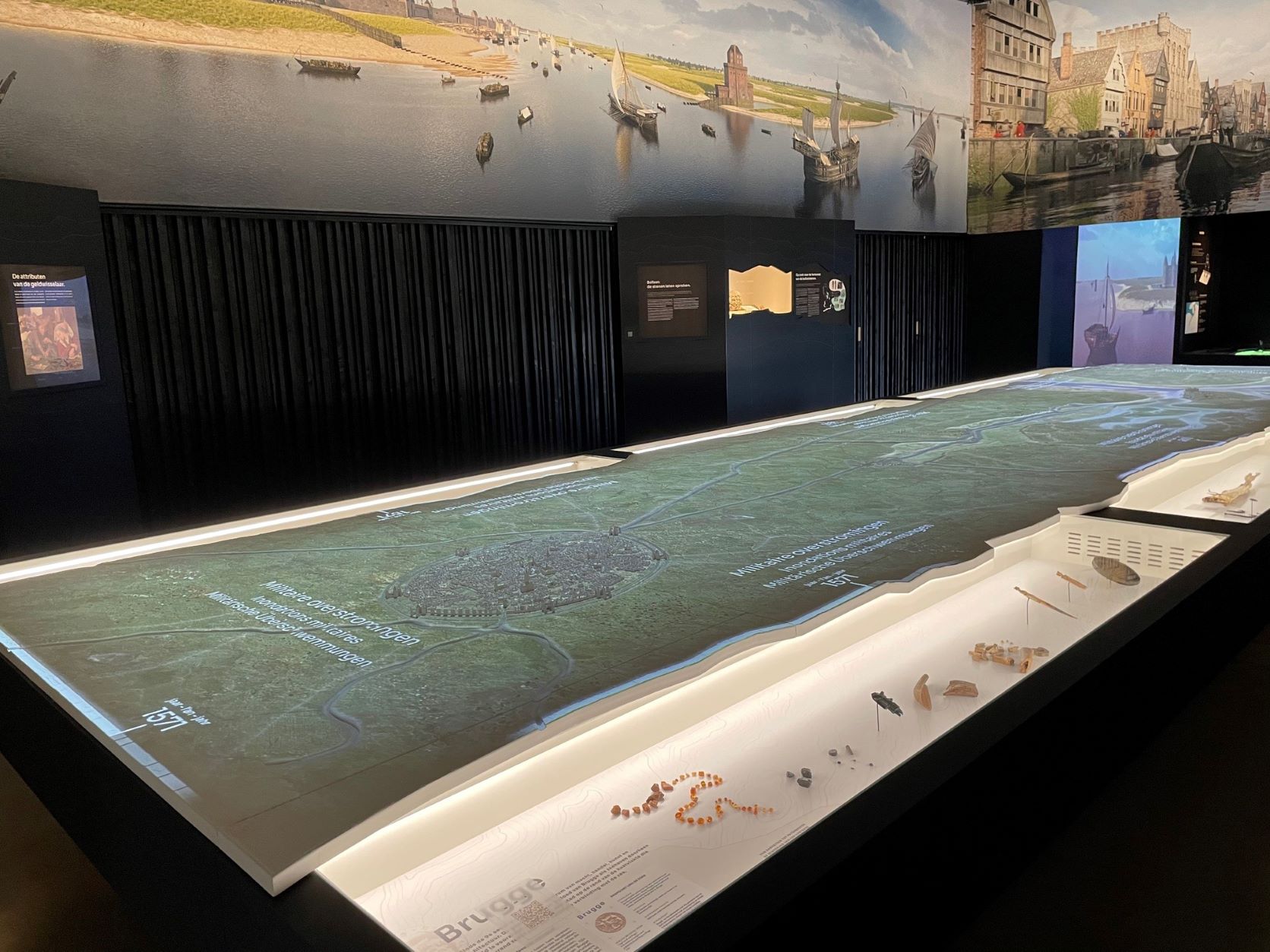
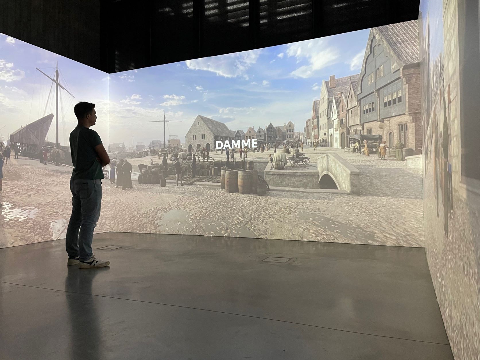
Figure 3: The immersive room at the Zwin Nature Park puts the visitor in the middle of the medieval harbours. Scientific accuracy was our goal in all of the VR and AR reconstructions.
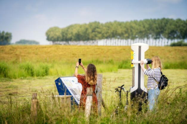
Figure 4: VR viewers visualize the medieval landscape and harbour atmosphere on the exact location of the archaeological sites. They offer visitors a new perspective on the historic dimension of their everyday surroundings.
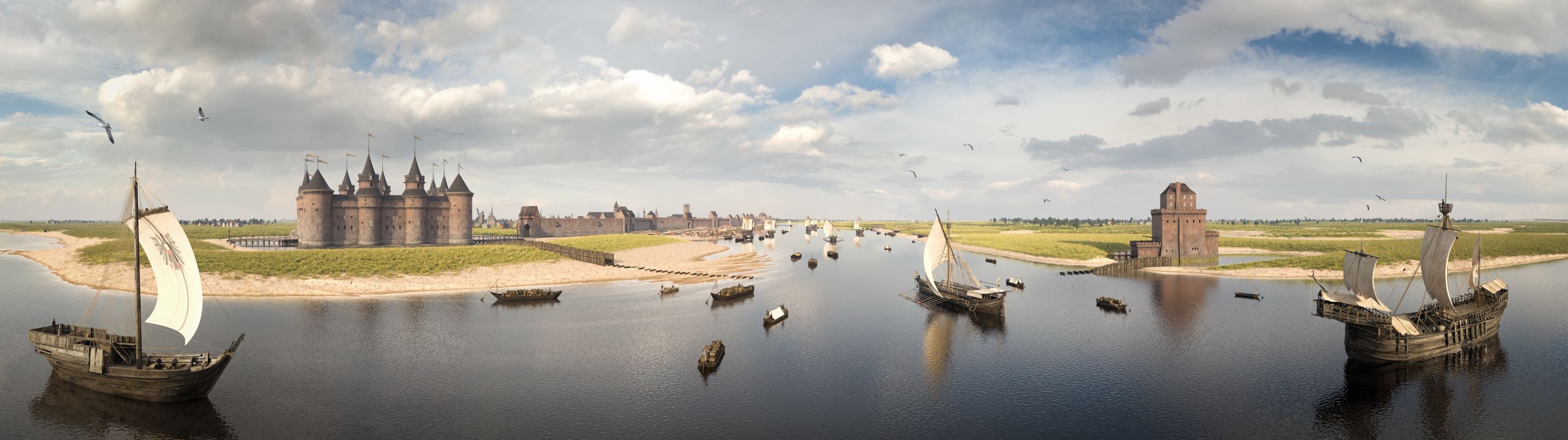
Main figure: VR reconstruction of Sluis and the Zwin tidal inlet in 1441 (© Ghent University, Westtoer and Timescope).